Locate Public Boat Ramps throughout the Region on the Portal
Find a nearby ramp to launch your boat with a new collection of interactive maps showing the locations of hundreds of publicly accessible facilities along the Mid-Atlantic coast.
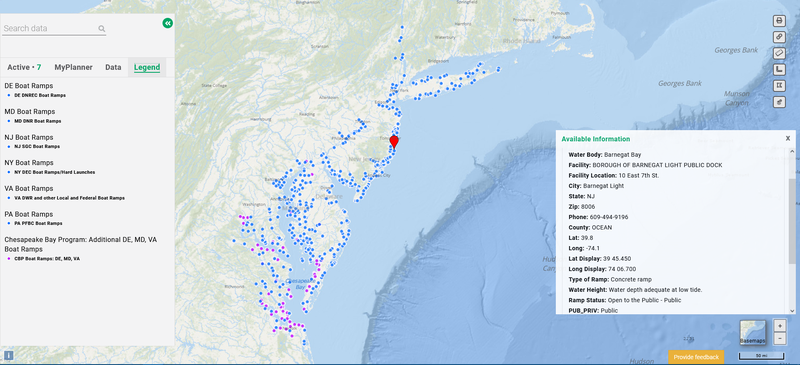
Portal users can click on the “Boat Ramps” dropdown in the Recreation theme for a list of seven map layers showing sites in the five-state Mid-Atlantic Regional Council on the Ocean (MARCO) region, plus additional points in Pennsylvania that offer convenient access to the Delaware Bay. The maps focus on ramps that are suitable for motorized vessels and located within 10 kilometers of the shoreline or the region’s major estuaries (Chesapeake Bay, Delaware Bay and Long Island Sound).
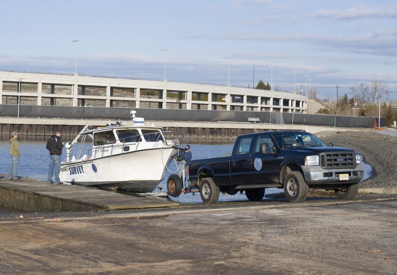
A boat is trailered down a ramp at Liberty State Park in New Jersey.
Users can click on any point for a popup containing details about the facility such as its name, address, operator, contact information, and links to websites with further information.
Below is an overview of the maps and sources of the data.
Mid-Atlantic State Maps
DE Boat Ramps: Featuring data provided by the Delaware Department of Natural Resources and Environmental Control’s FirstMap GIS hub.
MD Boat Ramps: This map depicts coastal ramp sites extracted from the Maryland Department of Natural Resources Online Water Access Guide. Visit the guide to view additional boat ramps located further inland and soft launch sites suitable for non-motorized boats.
NJ Boat Ramps: Featuring data compiled by the New Jersey Sea Grant Consortium.
NY Boat Ramps: Featuring data provided by the New York State Department of Environmental Conservation (NYSDEC). View the NYSDEC’s full map for additional boat ramps located further inland and soft launch sites suitable for non-motorized boats.
VA Boat Ramps: Featuring data from the Virginia Department of Wildlife Resources (VDWR) public boating access database and Virginia Coastal Zone Management Program records. View the VDWR Find Wildlife VA mapping tool for additional boat ramps located further inland and soft launch sites suitable for non-motorized boats.
Additional Maps
Chesapeake Bay Program - Additional Boat Ramps: DE, MD, VA: The Chesapeake Bay Program’s Public Access Sites GIS database provides the locations of additional boat ramps in Delaware, Maryland and Virginia that are not included in the maps above.
PA Boat Ramps: This map shows a selection of boat ramps from the Pennsylvania Spatial Data Access (PASDA) that are located along the southern reaches of the Delaware River and its tributaries. Users may view the PASDA Access Points (Fishing and Boating) map for additional ramp sites throughout the state.
Future Updates
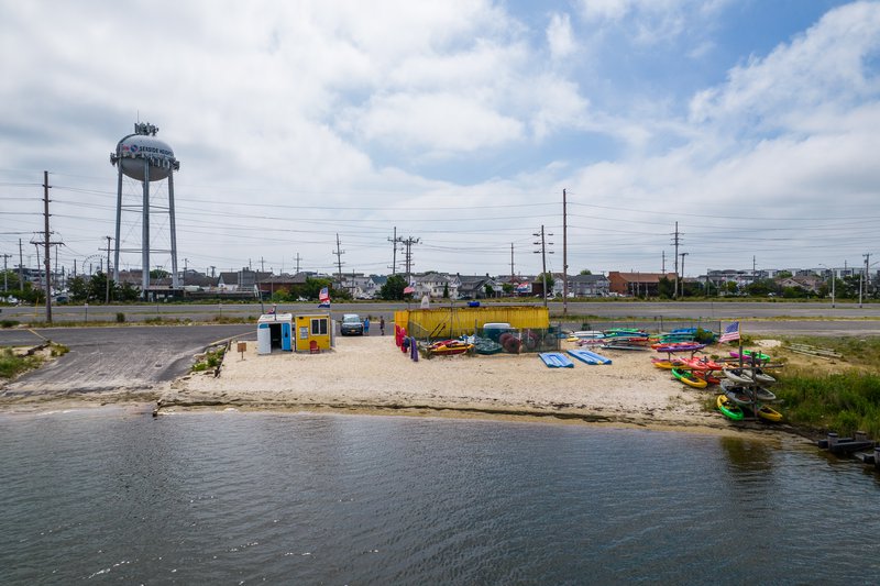
A boat ramp offering access to the Barnegat Bay in New Jersey.
This collection will be updated periodically to incorporate additional data that becomes available. If you’re aware of boat ramps along the Mid-Atlantic coast that are missing or datasets that should be considered for inclusion, contact us at portal@midatlanticocean.org.
The MARCO Portal team extends its thanks to the many state and regional agencies and organizations that provided source data and assistance in assembling this collection.
Share this story