- The Portal and other marine spatial planning tools were used to help design the alignment of an export power cable connecting to the first two active turbines in federal waters, located off Virginia Beach. Ocean Stories feature l
- Marine planners with the U.S. Coast Guard's Fifth District used the Portal to design proposed anchorage areas to accommodate future vessel traffic in the Chesapeake and Delaware Bay vicinities. Webinar
- When TE SubCom built a 4,000-mile submarine communications cable from Virginia Beach to Spain, it used the Portal to design an alignment that avoided hot spots for bottom-tending fishing activities such as dredging and trawling. Fact sheet
- Gotham Whale researchers are using the Portal to identify and build awareness of potential high-risk areas for marine mammal ship strikes in the NY-NJ area. Ocean Stories feature
- The Portal Team collaborated with the Mid-Atlantic Coastal Acidification Network to create a group of maps that will help researchers understand where monitoring gaps may exist in the region. Fact sheet
- The Portal served as a centerpiece in a course for New York K-12 teachers dedicated to the Hudson Canyon’s critical importance as a natural and economic resource. Fact Sheet
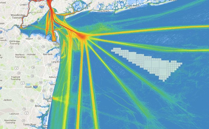
- Officials in the tugboat and barge industry are using the site to plan new routes that will steer safely clear of planned offshore wind areas in the Mid-Atlantic region. Fact sheet | Ocean Stories feature
- The U.S. Coast Guard is also using the Portal to help guide discussions and show maritime industry stakeholders how they prepare for the new infrastructure at sea. Fact sheet | Ocean Stories feature
How are you using the Portal? Have an interesting story about how our data helped your organization? Let us know at portal@midatlanticocean.org.