The Regional Ocean Assessment (ROA), an interactive report summarizing the region's ocean ecosystem and the many ways people interact with the Mid-Atlantic Ocean, is now available online at roa.midatlanticocean.org. In addition, information from the Marine Life Data and Analysis Team (MDAT) and Human Use Data Synthesis (HUDS) projects is currently being incorporated into the Portal as new map layers.
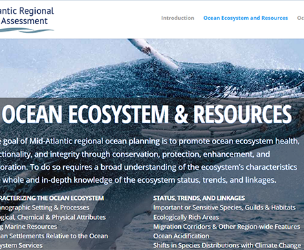
Like an electronic encyclopedia of the Mid-Atlantic Ocean, the ROA website contains a collection of entries that present narrative overviews of important scientific trends and facts pertaining to the region’s ecosystem, uses and economy. Users browsing the site can skip between topics ranging from how climate change is projected to impact Mid-Atlantic water temperatures and ocean chemistry to what the Panama Canal’s expansion will mean to the region’s ports. ROA entries include useful links to scientific reports and websites where users can explore the subjects in further depth.
The ROA site’s attractive design, engaging graphics and reader friendly approach make it suitable for both professional users and the general public. It is also compatible with mobile devices.
The Portal was instrumental in the creation of the ROA. The ROA site contains maps, links to pages and videos found on the Portal, and references the site in numerous sections.
At a Jan. 29 forum hosted by the Mid-Atlantic Regional Council on the Ocean (MARCO), experts provided updates on the ROA, MDAT and HUDS, all of which will help inform an Ocean Action Plan being drafted for the region in 2016.
Update: HUDS & MDAT Projects
The MDAT marine life data is undergoing the final stages of review and should be complete in March, according to project lead Patrick Halpin of the Duke University Marine Geospatial Ecology Lab. Once the review is concluded, the Portal Team will use the MDAT data to produce new gridded maps showing the ecological richness and abundance of species in sites throughout the region. Halpin described the process of gathering the information for these layers as “one of the largest aggregations of marine data taking place in the world.”
The HUDS project recently concluded with the creation of 10 new Portal layers that summarize the full range of human activities that take place at given points on the map. Project lead Melanie Schroeder Gearon of the consulting firm RPS ASA noted that when a Portal user selects multiple data layers, the system sometimes produces a murky map that is difficult to interpret. Further complicating matters, she said, are the many different ways that data can be represented, from polygons to colored dots to jagged lines.
The HUDS layers consolidated
all of the activities related to broad themes such as recreation, security
and fishing into single, easy to understand maps. These layers can now be accessed in Marine Planner by clicking on the Data tab and clicking on Human Use Data Synthesis.
Learn More at Webinars
Want to learn more about the ROA, MDAT and HUDS? Join us for a special series of webinars this spring with experts who helped produce them.
- The ROA
& the Portal: March 8 with Peter Taylor, Waterview
Consulting, Emily
Schumchenia, E&C Enviroscape -- Click here to watch recording
- The Marine Life Data and Analysis Team (MDAT) Project: April 5 at 11 a.m., with Patrick Halpin, Duke University Marine Geospatial Ecology Lab
- The HUDS Project & the Portal: May 3 at 1 p.m., with Melanie Schroeder Gearon, RPS ASA
Check the Calendar page for further details.