(Updated March 2018)
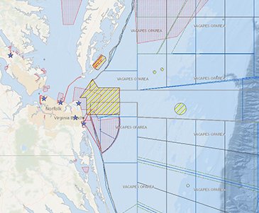
The Portal’s collection of Security maps was recently updated based on input from the Department of Defense and other federal agencies. The changes include the consolidation of several maps showing individual military training areas into a smaller set that covers the full Atlantic coast and the Gulf of Mexico, the retirement of select maps, and the addition of new maps designed to aid ocean planning work.
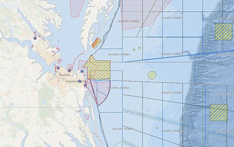
The following data can now be accessed by clicking on the Security theme in Marine Planner:
-
Danger Zones & Restricted Areas: Areas used for target practice, bombing, rocket firing or other especially hazardous operations.
Unexploded Ordnances: Weapons that did not explode when they were employed and still pose a risk of detonation.
Military Installation Location: Sites of 15 coastal military installations in the Mid-Atlantic and Northeast.
Military Operating Area Boundaries: Area in which national defense training exercises and system qualification tests are routinely conducted.
Military Regulated Airspace: Federally authorized airpsaces reserved for Naval flight operations.
Military Ship Shock Boxes: Areas where explosives are occasionally detonated close to surface ships to simulate near-miss situations.
Military Use Special Airspace: Areas designated for flight operations that can require limitations be imposed on civilian and other aircraft.
Military Submarine Transit Lanes: Areas where submarines may navigate underwater, including transit corridors designated for submarine travel.
Military Surface Grid Areas: This grid-like pattern delineates a series of smaller geographic areas within the Operating Areas for administrative and ocean planning purposes.
The maps were published by the National Oceanic and Atmospheric Administration and Bureau of Ocean Energy Management on MarineCadastre.gov in partnership with the Navy.
The Portal also hosts a layer in its Renewable Energy theme called the Department of Defense Offshore Wind Mission Compatibility Assessment, which- grades individual offshore wind energy lease blocks based on their compatibility with Department of Defense operations.
For more information on the Portal’s Department of Defense data, visit the Data Catalog’s Security section.