Nine new maps on the Portal show ocean areas, coastal rivers and watersheds along the East Coast that have been designated or proposed as critical habitat for endangered and threatened species by the National Oceanic and Atmospheric Administration’s National Marine Fisheries Service (NOAA Fisheries).
NOAA Fisheries describes critical habitat as habitat needed to support recovery of listed species. When a species is listed under the Endangered Species Act, NOAA Fisheries is required to determine whether there are areas that meet the definition of critical habitat. The designation of an area as critical habitat does not create a closed area, marine protected area, refuge, wilderness reserve, preservation, or other conservation area, nor does the designation affect land ownership. Rather, once critical habitat is designated, other federal agencies consult with NOAA Fisheries to ensure actions they fund, authorize, or undertake are not likely to destroy or adversely modify the critical habitat.
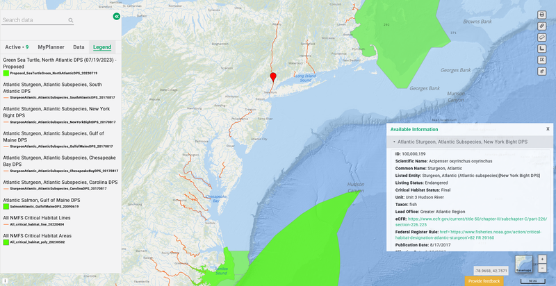
The maps can be found by clicking on the “National Marine Fisheries Critical Habitat” dropdown in the Habitat and Marine Life themes. Users can click any critical habitat polygon or line shown for a popup containing details about its status as well as links to relevant Federal Register notices and informational pages.
The collection includes two map layers that offer national views of critical habitat for multiple marine species:
- All NMFS Critical Habitat Areas: A national summary of active and proposed critical habitat areas offshore and in coastal areas. Species represented in waters from Cape Cod to Cape Hatteras include the endangered North Atlantic right whale and Atlantic sturgeon, which are both listed as endangered; and green and loggerhead sea turtles, which are listed as threatened.
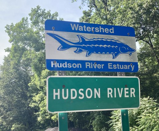
- All NMFS Critical Habitat Lines: On the East Coast, shows river lengths that have been designated as critical habitat for Atlantic sturgeon.
Users can click on “Designated” to view the following layers that break out specific critical habitat from New England to the Gulf Coast for Atlantic salmon and five distinct population segments (DPS) of Atlantic sturgeon:
- Atlantic Salmon, Gulf of Maine DPS
- Atlantic Sturgeon, Atlantic Subspecies, Carolina DPS
- Atlantic Sturgeon, Atlantic Subspecies, Chesapeake Bay DPS
- Atlantic Sturgeon, Atlantic Subspecies, Gulf of Maine DPS
- Atlantic Sturgeon, Atlantic Subspecies, New York Bight DPS
- Atlantic Sturgeon, Atlantic Subspecies, South Atlantic DPS
Finally, users can click “Proposed” for data depicting the boundaries of critical habitat that are now under consideration. This currently includes the following map layer:
The Portal’s critical habitat data will continue to be updated to reflect any newly proposed areas or those that undergo changes in status. Select maps showing proposed and final critical habitat designated by the U.S. Fish and Wildlife Service will also be added to the Portal in the near future.
Related Data

Users can view these critical habitat maps in combination with hundreds of layers related to the listed species on the Portal. The Marine Life theme contains a Sea Turtle Density Monthly Slider with maps for loggerhead and green turtles, a Tagged Loggerhead Sea Turtle Monthly Slider, and several maps depicting two decades of sea turtles strandings in the region.
Users may also search the Marine Life Library (Species Specific) theme for maps showing seasonal biomass of Atlantic sturgeon and models of North Atlantic right whale monthly abundance. Additional right whale products on the Portal include seasonal management areas, dynamic management areas, and speed zones, all located in the Maritime theme; and maps in the Marine Life theme showing change over time and strandings.
Questions? Contact us at portal@midatlanticocean.org.