
Two new data layers showing the Mid-Atlantic’s robust network of ferry routes and terminals have been added to the Maritime theme in Marine Planner. Both datasets are provided and maintained by the U.S. Department of Transportation’s Bureau of Transportation Statistics.
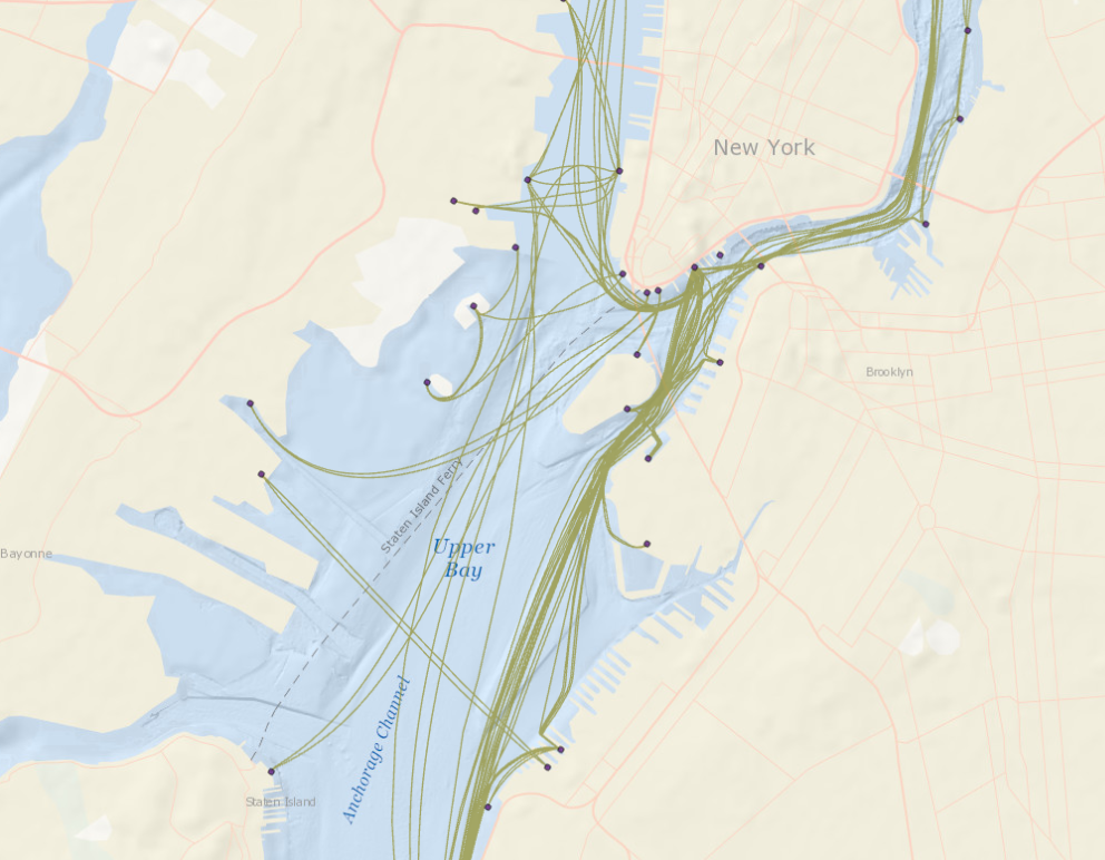
The Ferry Terminals map shows the origin and departure sites for ferries throughout the U.S. Portal users can click on the points for a pop-up containing information about the terminal’s operation and ownership status, geographic location and transportation connections.
The Ferry Routes map shows the approximate alignment of routes as determined through GPS and Automatic Identification System (AIS) data, as well existing government datasets from the Census Bureau, the U.S. Geological Survey, the National Oceanic and Atmospheric Association, and the U.S. Army Corps of Engineers. Users can click on any route for information about its operator, where it begins/ends, the time of year it runs and more.

The Maritime theme also contains a decade of interactive maps showing annual and monthly passenger vessel traffic concentrations in the region. To view them, click on the AIS Vessel Transit Counts or AIS Monthly Data Sliders for the year of interest and select the Passenger Vessel maps.