The Mid-Atlantic Ocean Data Portal has made several major updates to its collection of maps of fisheries management areas and closures based on feedback received from fisheries managers and industry members. The feedback was gathered as part of a collaborative project conducted by the Mid-Atlantic Regional Council on the Ocean (MARCO), Northeast Regional Ocean Council (NROC) and Responsible Offshore Development Alliance (RODA) through the NOAA Regional Ocean Data Sharing Initiative.
The updates include:
- Expanded collection of 59 management areas and closure maps (45 new)
- Layers organized by fishery/management plan
- New category for “expired” management or closure areas
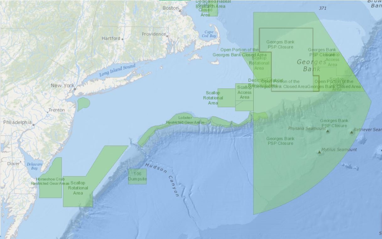
The Management Areas organizational scheme in the Portal’s Fishing theme now mirrors that used by the NOAA Fisheries New England/Mid-Atlantic Geographic Information Systems (GIS) page, which groups data based on fishery management plans such as Northeast Multispecies (Groundfish), Atlantic Sea Scallop, Monkfish, and Northeast Skate Complex. The layers displayed on the Portal within these categories are derived from the data on the NOAA Fisheries GIS web page, and links to data downloads and metadata point directly to NOAA Fisheries online resources. The data and maps shown in these categories are not the complete set of regulations.
The Expired Management Areas dropdown contains layers for management or closure areas that are no longer being applied within current fisheries management regulations. Industry members in particular felt that these layers were important to display to give context to other maps and data on the Portal that depict fishing activity. Patterns of fishing vessel activity in any given year are the product of multiple factors including the currently managed or closed areas.
By overlaying fishing vessel activity data organized by year(s) with the management or closure areas in place for those year(s), users can better understand drivers of fishing activity and explanations for year-to-year changes. One fishery where this understanding may be of particular importance is the Atlantic Sea Scallop fishery, which experiences a “rotational area” management scheme. Now Portal users can explore similarities and differences between the current Sea Scallop Rotational Areas and the previous scheme that was in place during 2019.
The Portal’s Management Areas data layers leverage the NOAA Greater Atlantic Regional Fisheries Office (GARFO) program for maps and GIS data for fisheries management, protected resources management, critical habitat, and habitat conservation.