The U.S. Coast Guard (USCG) and Mid-Atlantic Ocean Data Portal team have partnered to create three new maps showing proposed anchorage grounds in the Chesapeake and Delaware Bay areas and a Port Access Route Study (PARS) area extending offshore from Cape Hatteras, North Carolina, to Ocean City, Maryland. All three maps can be found by clicking on the “USCG Proposed Areas and Studies” dropdown within the Portal’s Maritime theme.
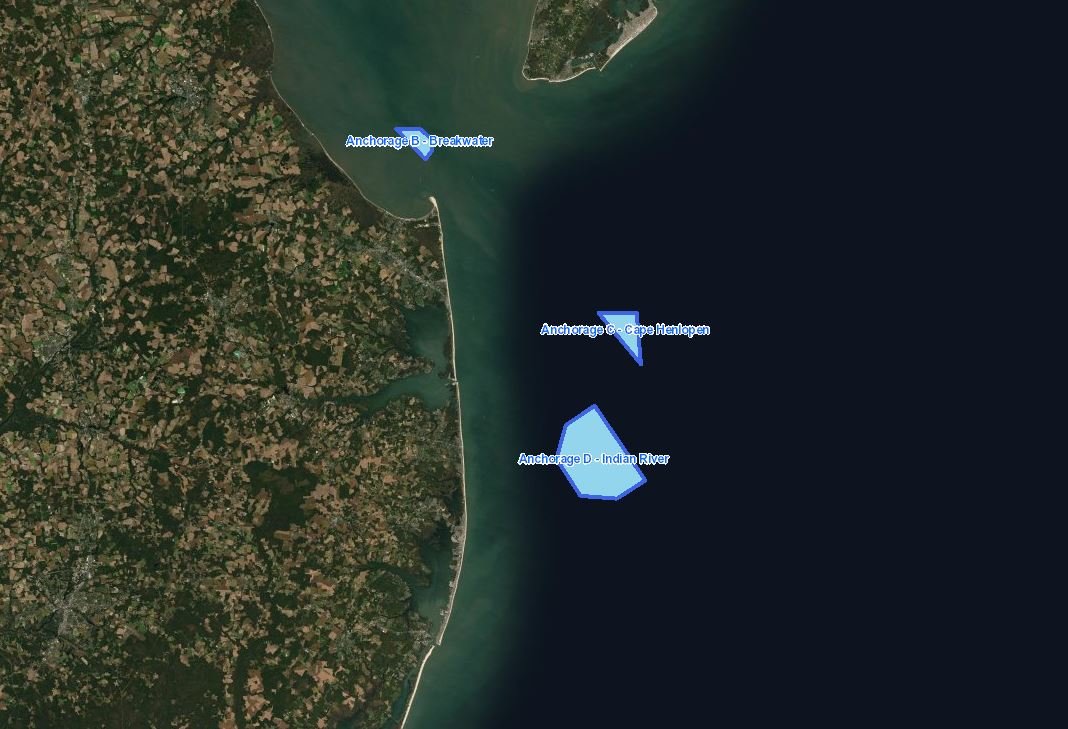
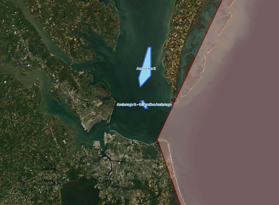
The USCG Delaware Bay Anchorages map shows two zones located off the coast of Delaware and a third located in the bay between Cape Henlopen, Delaware, and Cape May, New Jersey. The two proposed Anchorage Areas at sea are located adjacent to BOEM offshore energy lease areas, and would accommodate the increasing number of vessels that are expected when construction of the wind farms commences.
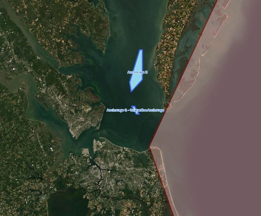
The USCG Proposed Lower Chesapeake Bay Anchorages map shows a pair of zones in the Hampton Roads, Virginia, vicinity. According to the USCG, the areas were proposed to ensure that the area’s anchorage grounds can continue to safely and effectively support current and future deep-draft vessel anchorage demands in light of increasing vessel sizes and traffic volumes and maritime infrastructure improvements in the area.
Users can also activate the Portal’s Anchorage Areas layer to view the locations of existing areas throughout the region.
Port Access Route Study Area
The USCG Chesapeake Bay PARS Study Area map covers an approximately 50,000-square-mile area off the coasts of North Carolina, Virginia and Maryland. It is anticipated that the Fifth Coast Guard District, based in Portsmouth, Virginia, and the Coast Guard Sector Hampton Roads will conduct the study over the next 12 months.
PARS are the means by which the USCG determines the need to establish traffic routing measures, shipping safety fairways, traffic separation schemes, limited access areas, recommended routes and regulated navigation areas in order to ensure navigational safety in the nation’s offshore approaches and coastal waters.
The USCG is conducting the Chesapeake Bay PARS to determine
whether a shipping safety fairway and/or routing measures should be established
in the bay’s approaches. It will consider whether existing or additional
regulations and routing measures are necessary to improve navigation safety due
to factors such as offshore development, current port capabilities and planned
improvements, increased vessel traffic, changing vessel traffic patterns,
weather conditions, or navigational difficulty. The study would supplement and
build upon recommendations set forth in the USCG’s Atlantic Coast Port Access
Study, completed in 2017.
Watch Our Webinar
You can learn more about the PARS and proposed anchorage areas in our 2020 "How Tuesday" webinar below. Guest presenters Jerry Barnes and Matt Creelman of the Fifth Coast Guard District provided additional information on the study and anchorage areas and discussed how the Portal can be used to analyze the sites.