Learn about the volumes, sources and sites of wastewater discharge in the ocean and its tributaries with three new map layers available on the Portal. The Wastewater Outfalls and Discharge Flow, Wastewater Outfall Pipes, and Wastewater Facilities maps can all be found in the Water Quality theme in Marine Planner.
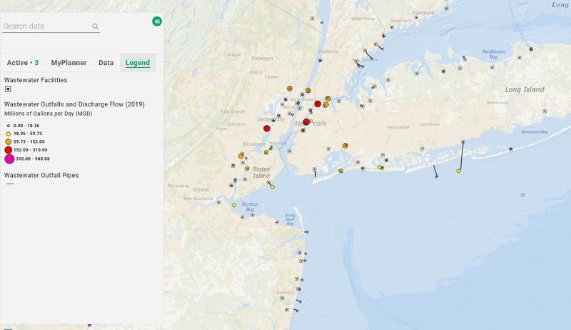
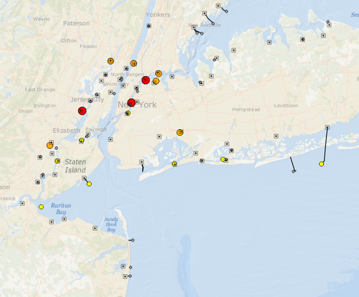
In creating the Wastewater Outfalls and Discharge Flow layer, the MARCO Portal Team matched National Oceanic and Atmospheric Administration (NOAA) data pinpointing the sites of discharges in the Mid-Atlantic region with Environmental Protection Agency (EPA) data expounding on the nature of the discharges. The map shows five different flow levels at each discharge site, ranging from 0-18.36 million gallons per day (shown in smaller gray circles) to 310-940 million gallons per day (seen in larger pink circles). Flow volumes from 2019 were chosen because it was the last full year of available data before the COVID-19 pandemic, which impacted water and sewer use in regional job centers through widespread telecommuting and quarantining measures. This data will be revised at a later date.
Users can click any circle for a popup containing 19 categories of data, including details about the facility generating the wastewater and links to EPA information about the types and sources of pollutants. The map replaces and improves upon the former Offshore Discharge Flow layer, which only showed outfall locations in the ocean. The new map includes data in key coastal tributaries such as the Chesapeake Bay, Delaware Bay and River, Hudson River and Long Island Sound.
The Wastewater Outfall Pipes layer shows the routes of publicly owned point source discharges to surface waters at or near the Atlantic coast. Outfall pipes and discharge points may not be present for some facilities due to a lack of source data.
The Wastewater Facilities map shows the location of publicly owned treatment works along the Atlantic coast. Users may click on any point for a popup with geographical information and a link to an EPA report about the facility.
The Wastewater Facilities and Wastewater Outfall Pipes data were produced by the NOAA Office for Coastal Management and first published on MarineCadastre.gov.