Every map tells a story. We help you share yours.
The Portal connects agency, industry, and community leaders who are shaping the future of our ocean to the best available data on ocean science, maps, and each other through a sta…
The Portal connects agency, industry, and community leaders who are shaping the future of our ocean to the best available data on ocean science, maps, and each other through a sta…

(Updated February 2025. For the latest offshore wind data, view the Renewable Energy theme in Marine Planner.)The importance of reducing greenhouse gas emissions, achieving energy…
The following is the first in a two-part series focused on offshore wind energy transmission siting. Part II looks at the design and construction process for a cable connecting to…
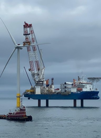
The following is the second in a two-part series focused on offshore wind energy transmission siting. Part I provided an introduction to the planning process involved with designi…

The commercial fishing industry has been woven into the Mid-Atlantic region’s cultural fabric and economy for over 300 years. Today it generates a half-billion dollars in landings…
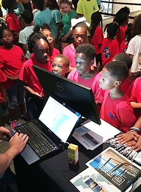
It started with a tweet. Tiara Moore, a postdoctoral scholar at the University of Washington, had been following the variety of “Black In” science weeks that were launched after t…
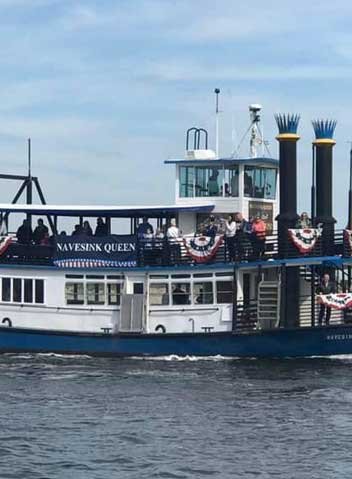
The big wheels keep on turning for the Navesink Queen. After a long run serving passengers in Virginia as a ferry, the old-time paddle wheeler was purchased by Capt. Dan Schade in…

Twenty thousand years ago, the vast underwater plain we know as the Mid-Atlantic’s continental shelf was dry land and the region’s beaches were 100 miles east of where they are to…

It’s Black Friday, and while millions in the New York City area are out spending greenbacks, a group of about 50 is getting ready to search for humpbacks.
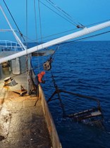
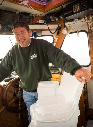
Kenny and Art Ochse, owners of the fishing vessel Christian and Alexa, recently welcomed Ocean Stories aboard to observe a typical day at sea. Come along with our trip diary and l…
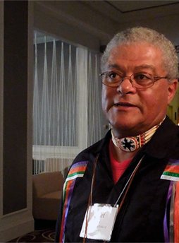
Chief Dennis Coker has become a prominent voice on Mid-Atlantic ocean planning issues, often representing his tribe and other members of the Confederation of Sovereign Nanticoke L…
The growth of satellite AIS technology has somewhat mirrored that of the Internet itself. Initially created for security purposes, its use expanded exponentially once the private …
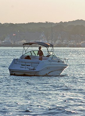
A survey of Mid-Atlantic saltwater boaters found that the average annual cost of owning and maintaining a vessel runs about $7,722. The survey, which was conducted over the course…
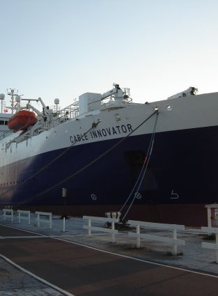
Telecommunications play an integral role in our everyday lives. The speed and consistency that we are able to make phone calls and access information online is supported by a larg…

Tugboats, towboats and barges are the worker bees of maritime transportation.
In the nearly 35 years Captain Hawkins has been fishing off Maryland’s coast, he’s seen an increase in some fish populations as well as a decline in others.

Through a collaborative partnership between the Surfrider Foundation, Monmouth University, The Nature Conservancy, and Point 97 there is now non-consumptive recreational use data …
The success of ocean planning in the Mid-Atlantic relies on the ability for disparate groups to effectively communicate their concerns and needs to one another.